15726 Views
Roadtrends
Road and cinema: the films that take us for a drive
What do films like Crash, Mad Max and Speed have in common? Well, in
Dr Margarita Martínez Díaz, of the University of A Coruña, is one of the winners of the XVI International Prizes for Infrastructure Management and Road Safety given by the International Network of Abertis Academic Chairs
It’s the first university think tank that seeks to improve road safety as part of its advanced study plans. Last October, the International Network of Abertis Academic Chairs awarded its XVI International Prizes for Infrastructure Management and Road Safety, which recognise the best university works from among the five international editions of this award (Spain, France, Puerto Rico, Chile and Brazil).
With her thesis Highway travel time information systems: From traditional to cooperative driving environments, Dr Margarita Martínez Díaz (UDC, University of A Coruña) took the Abertis Prize Spain in the Doctoral Thesis category.
For his part, doctor Mario Soilán Rodríguez (Vigo University) won another prize, in the Road Safety category.
In addition, Abertis Prizes “ex aequo” were presented in the Master Thesis category to Francisco Garrido Valenzuela (Pontificia Universidad Católica of Chile) and to Verônica Ghisolfi (Universidade Federal of Rio de Janeiro).
We chatted with Dr Martínez Díaz about the contents of her thesis and other matters related to mobility.
Could you tell us briefly about the contents of your thesis?
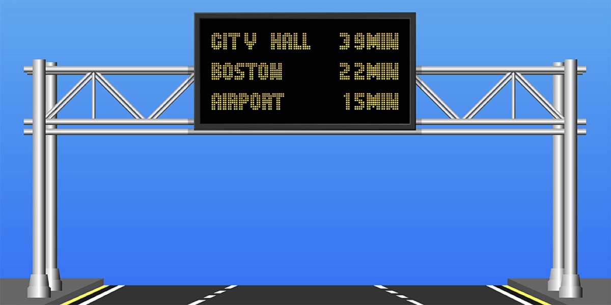
The central aim is to predict travel times in real time. I would also stress that this entails a high level of precision and a methodology that can easily be applied by any traffic management centre.
It’s important to stress these two points, because there already exist other methods for predicting travel times in real time, but none of this is as advantageous as this one. Among the existing ones, some (the majority) use very common technology but yield imprecise information, especially at times when there is congestion, which is precisely when information about travel time is most important.
An example would be the methods based on regular measures of speed, which are still the ones that are most employed in the management centres, or the ones based on data that comes from automatic vehicle identification systems or from tracking systems.
On the other hand, we have methodologies that are capable of making good predictions, but it wouldn’t be practical to apply them in most cases because they require expensive and complex technologies, in addition to considerable computing capacity. I’m thinking, for example, of methods based on artificial intelligence, among others, that are used for research or in pilot tests.
In all probability, they will play a fundamental role in the future, but we’ll still have to wait a good number of years to see them, whereas congestion problems have to be solved as soon as possible, so as to avoid their direct and indirect costs.
Could we say, then, that it is the greater precision of this system that differentiates it from applications like Google Maps or Waze?
To be more exact, I’d say that the methodology I’m presenting is special for its precision and robustness. Let me explain: there are times when Google Maps, Waze, etc. provide accurate information, but that’s not always the case. The precision of their estimates depends on the number of users who are connected at the time when information is requested, and this number can vary. This doesn’t occur with the fusion methodology that I propose.
But another aspect must be taken into account: already today, but especially when autonomous and connected mobility becomes a reality, traffic management should not depend either on individual users nor on private companies, but on management centres whose aim is the overall optimization of traffic flow, as opposed to individual or business interests. Only in this way will we achieve more efficient mobility.
The mathematician and transportation analyst John Glen Wardrop already explained this.In one of my articles n I explain one of them with a simple example. Let’s imagine a large group of drivers who all want to get to the beach on a Sunday morning in summer from the centre of the city. They check the apps on their cell phones and receive more or less the same information: route A is the shortest and safest. Naturally, they take route A. But halfway through the trip they receive a warning that there has been an accident a few kilometres away along Route A, and are advised to take an alternative route, B.
Most of the drivers will change to the new route, which will gradually become congested. Most of the apps will then propose changing to route C, which will also later become congested. And so it goes. This simple example shows that the use of information should be accompanied by a management strategy that will have to be applied by a higher control unit. Most logically, by a traffic management centre.
This doesn’t mean I’m opposed to this kind of applications. Not at all, and in fact I use them in my personal life. I’m just saying that traffic management cannot depend on information that we obtain from them.
Is the system devised exclusively for travel on highways and motorways, or could it also be used on other kinds of roads and in urban settings?
The methodology I present in the thesis could be used on any path with an uninterrupted flow of traffic (highways, motorways, fast roads, uninterrupted stretches of conventional roads, etc.).
With the necessary modifications, it could also be extended to uninterrupted or discontinuous flows (for example urban traffic) and in that case we’d have to see just how advantageous it would be. Very probably, yes.
What kind of data and technology are required to receive the information necessary to make these predictions?
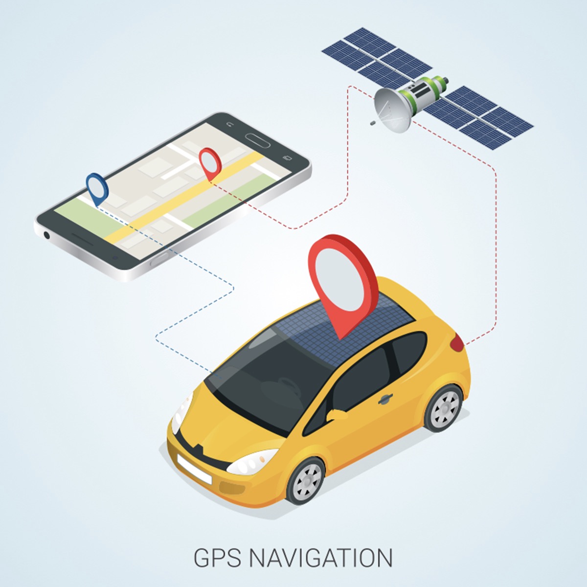
The nucleus of the methodology consists in the fusion, be means of a mathematical algorithm, of direct and indirect measurements of travel times. This is the principal data that must be collected in real time so as to be able to make the predictions.
The direct measurements of travel times are obtained either through the already-mentioned systems of automatic vehicle identification (AVI) –including cameras capable of identifying license plates, Bluetooth signal detectors, readers of automatic charge cards, etc.– or through tracking systems (like GPS or geolocation of cell phones, for example).
The nature of these measurements is different, but the methodology already takes into account the variations necessary for assigning a value to each of them.
The indirect measurements of travel time are estimated from data provided by loop detectors (magnetic spires), that are found along all roads of a certain importance.
How is it possible to meet present mobility needs while, at the same time, getting ahead of future problems?
As for mobility, the objective to be achieved are basically the same today as in the future. We want efficient, safe mobility that respects the environment and that is inclusive. And that’s what we want in driving situations in the future. What will be different are the special challenges to meet so as to reach those goals, as well as the available tools.
What seems to be clear is that information about travel time will continue to be of vital importance for both individual drivers/passengers and for the management centres. The former will be able choose alternate routes or change the hour of departure. At a minimum, if they get into a traffic jam their stress levels will be lower because they will have necessary information about the delay, which is positive from both safety and health standpoints.
There are already studies that indicate that while in the future we may be passengers in a self-driving vehicle and thus have the chance to do other things during the trip (and even work), being caught in a traffic jam will still have direct and indirect costs. For their part, the management centres will be able to actívate dynamic traffic management systems based on this information, when necessary. Just as is the case today.
What is certain is that in the inter-connected future, management methodologies will be much more complex, as will the technologies used, the communications, etc. As I said earlier, artificial intelligence will come to play a fundamental role. The fusion of data from different sources will be more necessary than ever.
As a result of all this, the methodology that I propose will not be sufficient on its own, but because of the way it is defined it could perfectly well be integrated into a more complex fusion system. In other words, it could be extended so as to be capable of serving future needs.
Will these new players and settings favor the ‘precision’ with which systems like yours will be able to predict driving times?
As new settings become reality, and for example there are more sensors on the roads –the vehicles themselves will be ‘sensors’, and in fact are to a degree today– the more chances there will be to improve the predictions of travel times and the dynamic management of traffic in general.
It’s true that it’s not enough to collect a lot of data. If it is ‘bad’ data (data with lots of noise, imprecisions, unimportant information) or if we don’t know how to manage it adequately –if we don’t define a model that uses the data correctly to achieve the information we want– well then the results could be more imprecise than what we’re getting today.
Having a lot of data and technology offers great opportunities, but we have to know how to take advantage of them.
With systems like this one, in the future will it be possible that mobility will cease to be a big headache for the different administrations?
I’m optimistic in this sense. Maybe we’ve taken too long to react, and that’s why there are now big problems with mobility, both direct (congestion, accidents, etc.) and indirect (contamination, noise).
But in recent years mobility has entered the center of public debate, and both users and public administrations and private companies are realizing how important it is and that smooth road travel still isn’t guaranteed.
There are many initiatives that are trying to resolve the many challenges. We researchers are also working hard to make significant contributions. Not to mention that automobiles are attractive and that this, as long as it doesn’t distract us from the principal aims we’ve already mentioned, helps mobility attract the attention it deserves.
That’s why I do believe that, although it will take time, the mobility of the future will be better than what we have today, in every sense.