9535 Views
Mobility
Flying away, a new form of sustainable mobility in the city
¿Es un pájaro o es un avión? No, es Volocopter. Un taxi volador cuya
Travel wasn’t common during Antiquity. As explained by Maribel Bofill, profesor of driver education, communicator and blogger at Gladiatrix en la Arena, “for the immense majority of the populace, life was almost totally confined to the area that could be covered on foot between sunrise and sunset. At the most, some thirty or forty kilometres from where one lived.” Longer distances were for soldiers, tradesmen “and other disreputable people.”
Nevertheless, roads and highways were essential for the expansion of certain civilizations. This was the case in ancient Rome, especially in the period of the Empire. Those practical Romans soon understood the need for a road network that would connect the territories under their dominion so as to favor commerce.
The construction of roads beyond their frontiers was also essential for expanding the Empire. The Romans took on the ambitious task of building a communications network from the Atlantic Ocean to the Red Sea, and including the British Isles and the Back Sea. Most of these roads were still being used during the following millennium and even longer, according to Bofill.
So much so that many of today’s roads and motorways still respect the old Roman lines. This is the case with the Ruta de la Plata (A-66), which runs between Gijón and Seville. To find the origin of this road we would have to go back in time to the 7th century BC, when the Tartessos used a natural corridor that the ran through the western part of the peninsula to connect and trade with the northern part of the plateau.
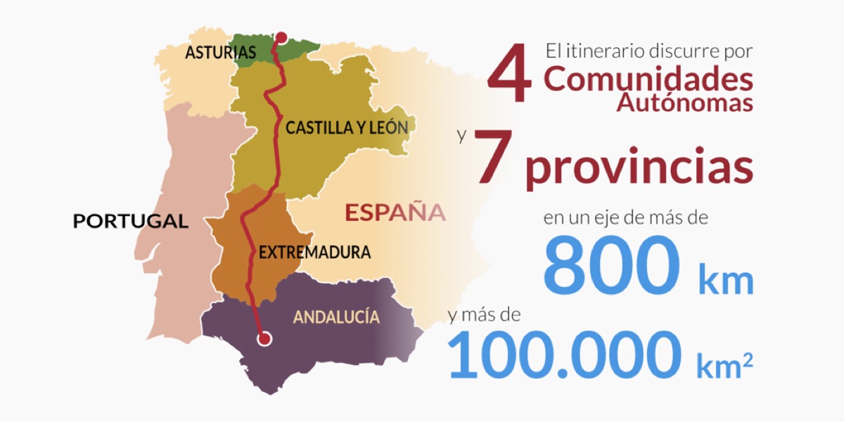
As explained at Rutadelaplata.com, it was during the time of the emperor Augustus, and especially with Trajan and Hadrian, when this route became a Roman road: “In the beginning it linked Emerita Augusta (Mérida) with Asturica Augusta (Astorga), and continued through the south to Seville and to the north to Gijón along the Vía Carisa… The old road and its natural extensions created a great communications route that linked the Cantabrian Coast with the lands in the south of Hispania.”
The longest Roman road on the Iberian Peninsula, the Vía Augusta, with a length of 1,500 kilometres –it linked today’s Cadiz with the Pyrenees– can still be detected in some of the current highway network. One of them is the A7, also known as the Autovía del Mediterráneo, which goes from Algeciras to Barcelona. Also, the N-340, between Cadiz and Barcelona: in the first part, as far as Murcia, it follows the old Vía Augusta.
In Italy, the old Vía Aemilia, which links today’s cities of Rímini and Piacenza, is part of the Strada Statale 9 Via Emilia.
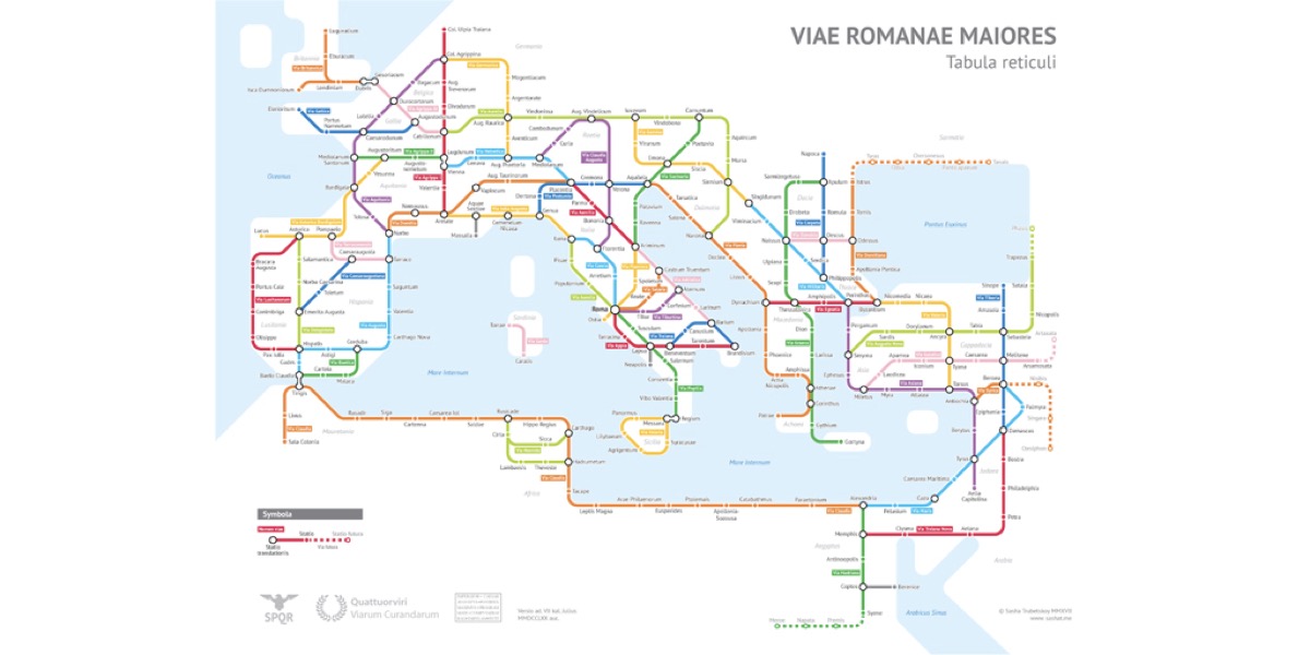
But what was the Empire’s road map like? Since there was no Google Maps at the time, some recent projects have attempted to trace what it would have looked like. One of them is provided by the American designer and statistician Sasha Trubetskoy.
Using classical sources, such as the Itinerario Antonino, or modern ones like the Pelagios Network, among others, Trubetskoy has mapped out the principal Roman highways that existed in 125 AD, inspired by modern urban Underground maps.